
iXBlue is a leading global provider of innovative solutions and services for navigation, positioning and imaging. Civil and defence customers rely on our systems, operations and services for the challenges they face at sea, on land, in the air or in space.
We are recognised throughout the industry for our pioneering work on the development of ultimate performance fiber-optic gyroscopes (FOG), acoustic and sonar signal processing, and inertial-acoustic sensor data fusion. In all of these areas, we work to ensure that our products provide high accuracy, unrivalled performance and unsurpassed reliability.
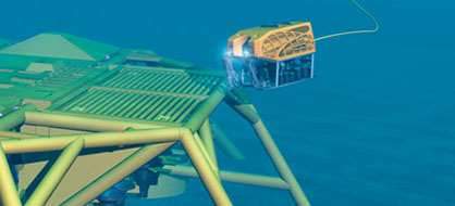
Installing structures on the seabed can be challenging, particularly in harsh environments. In these operations, the key requirements for our customers are reliability, safety, performance and efficiency. iXBlue’s activities in this segment focus on providing support for dredgers and for organisations installing infrastructure for the offshore energy industry.
Our systems are fitted on ships, platforms and subsea vehicles, such as remotely operated and autonomous underwater vehicles, or are deployed on the seabed. Many major operators recognise the critical contribution that field-proven iXBlue solutions make to the efficiency of offshore operations.


Subsea navigation and positioning
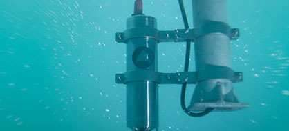
iXBlue offers inertial navigation, USBL and synthetic LBL positioning and tracking, and inertial-acoustic metrology solutions for civil and defence underwater and oceanographic activities:
- Gyrocompasses and inertial navigation systems
- USBL positioning systems
- Synthetic LBL positioning systems
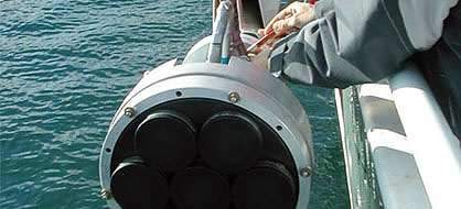
- Acoustic transponders
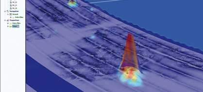
Seabed mapping
iXBlue provides seabed mapping system solutions, combining synthetic aperture sonars (SAS) or sub-bottom profilers (SBP) with advanced geophysical, seismic and sonar software:
- Geophysical software
- Synthetic aperture side-scan sonar
- Sub-bottom profilers and very low-frequency transducers
Moorings and releases
iXBlue provides an extensive range of remotely controlled release systems designed for mooring applications in shallow water to full ocean depth, and from light to heavy loads:
- Acoustic releases
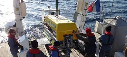
Survey services
iXBlue offers expert services for the measurement and analysis of physical, chemical and biological marine environments:
- Services by iXSurvey