
Researchers have found that using operational civilian satellites may provide close estimates of relative oil thickness and volume for large-scale oil spills in the ocean.
The results were published in the Journal of Applied Remote Sensing and according to its associate editor, Weilin Hou, it is a ‘critical scientific advancement for monitoring large-scale oil spills’.
Go deeper with GlobalData

Hou also believes that the research will make it easier to assess and understand the impact of oil spills on marine and coastal resources, as well as making it easier to prepare appropriate responses for future spills.
The open-access article, ‘Remote Sensing Estimation of Surface Oil Volume During the 2010 Deepwater Horizon Oil Blowout in the Gulf of Mexico: Scaling up AVIRIS Observation with MODIS Measurements’, suggests that optical remote sensing observations from coarse-resolution satellite instruments can estimate the thickness and volume of large oil slicks in the vast ocean when some fine-resolution aircraft measurements are available.
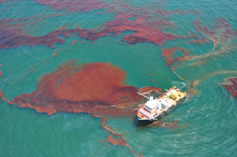
This concept was tested when the Nasa instrument MODIS, located on satellites Terra and Aqua, and the Nasa airborne instrument AVIRIS had their measurements of the Deepwater Horizon oil spill in the northern Gulf of Mexico combined.
The resulting map of the largest marine oil spill in history revealed surface oil volume, relative oil thickness and probable distributions of the various thickness.
How well do you really know your competitors?
Access the most comprehensive Company Profiles on the market, powered by GlobalData. Save hours of research. Gain competitive edge.

Thank you!
Your download email will arrive shortly
Not ready to buy yet? Download a free sample
We are confident about the unique quality of our Company Profiles. However, we want you to make the most beneficial decision for your business, so we offer a free sample that you can download by submitting the below form
By GlobalDataIn the paper, the researchers conceded that there may be uncertainties in the data, as there is no means to measure oil thickness in the field to validate their estimates.
However, they were optimistic that the approach represents ‘a step forward toward the ultimate goal of identifying areas of thick (actionable) oil using readily available satellite data.’
The researchers suggested that remotely sensed oil distribution maps may ‘also help assess a spill’s potential impacts to the marine environment’.
University of Portsmouth marine zoologist Dr Gordon Watson said: “Scientists have used the power of satellite imagery to measure key parameters such as surface oil volume and oil thickness [of the Deepwater Horizon spill] and tracked these through time.
“Not only will this enable researchers to assess the full extent of the 2010 spill, but it should provide much more accurate modelling and forecasting for future spills. This will be critical in remote environments such as the Arctic, which are already firmly in the sights for exploration and extraction.”
The paper’s conclusion echoed Watson’s sentiments, stating that their approach may be used in future spills to provide rapid assessment of thin and thicker oils on the ocean surface ‘in order to help response efforts in near real-time and post-spill assessment retrospectively’.
The research was a collaboration between universities, government agencies and industry.
“The work this team produced has the potential of very important environmental, economic, and social impact for us,” said Hou.
“The more accurately we can assess the volume of oil spills at synoptic scale, the better we can plan mitigation efforts for future spills, and the better we can assess how such spills affect our marine and coastal communities and environments, in order to best apply our resources.”
