4D Nav specializes in geomatics and software engineering services, quality control (QC) services, and 3D modeling capabilities for the offshore industry.
Software packages to support offshore operations
4D Nav’s software packages focus on efficiently solving a client’s geomatics and engineering problems by providing in-depth spatial data analysis and visualization in support of offshore operations and offering integration with engineering applications.
The company’s packages are used during the planning phases and in real-time during operations in order to prevent unforeseen and costly situations.
With its software’s 3D display capability, 4D Nav models and displays complex subsea fields, including catenaries and other elements in the water column, as well as interfacing closely with Orcina’s OrcaFlex™ finite element analysis (FEA) engine to model complex entities such as risers, pipelines, anchor lines and umbilicals.
Innovative and modern positioning and navigation software
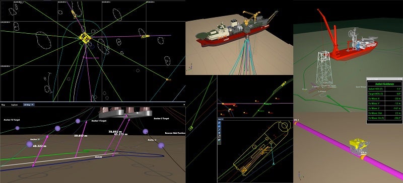
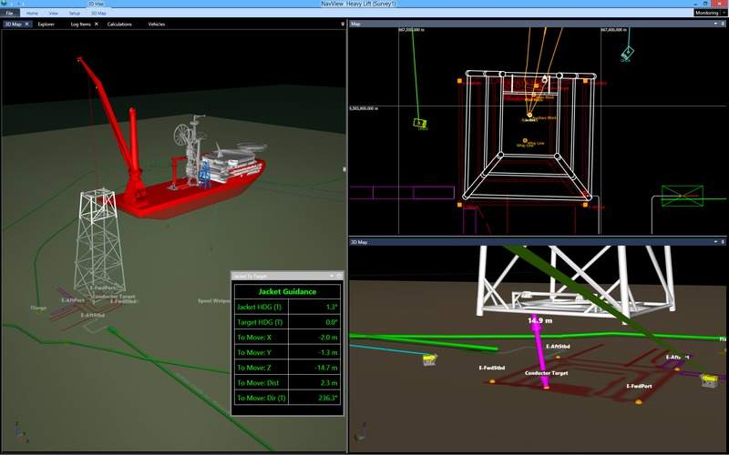
NavView is a positioning and navigation package that combines 4D Nav’s engineering, surveying and software development experience with innovation and modern software technology.
The package incorporates awareness of 3D elements such as the seafloor and other elements, including subsea structures, pipelines, risers, umbilicals and anchors.
Combined with 4D Nav’s robust surface and subsurface positioning algorithms, the result is a powerful real-time visualization package for challenging offshore operations.
Visualization and planning tools for subsea applications
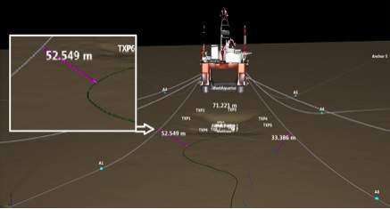
4D Nav’s RigNav package offers advanced subsea visualization and rig move planning tools for offshore drilling and production environments. Based on the NavView suite, RigNav simplifies the task of planning inter-well rig moves, and improves the client’s confidence and safety of subsea operations.
Position data from sensors or third-party software systems can easily interfaced with the system and are used to update real-time 2D and 3D views of the vessel and remotely operated vehicles (ROVs).
The advanced 3D modeling provides spatial awareness advantages, especially when ROVs are operating around critical infrastructure.
Real-time data visualization software for pipe measurements
PipelayView is a real-time application capable of connecting to ships’ sensors, and providing graphical and numerical displays of pipe installation parameters compared against design metrics. The package integrates the OrcaFlex FEA engine to allow pipe catenary, touchdown, tensions and fatigue to be modeled in real-time.
A scanning laser or other sensor mounted with a view of the pipe exit on the lay vessel may be used to precisely detect and measure the pipe exit angle, which is displayed on a bullseye chart incorporated into the PipelayView screen.
PipelayView computes fatigue induced on a pipeline when it is being held by the hold-off module (HOM), and potentially extends the timeframe for welding and other operations.
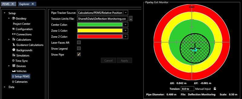
Pipelay exit monitoring systems
4D Nav’s pipelay exit monitoring system (PEMS) provides pipelay operators with a simple and reliable tool for visualizing and logging the position of the pipe relative to an ideal exit angle.
PEMS is a subset of the PipelayView software, and incorporates a laser measurement system to continuously monitor and record changes to the pipe center position as it exits the lay vessel tensioner or HOM.
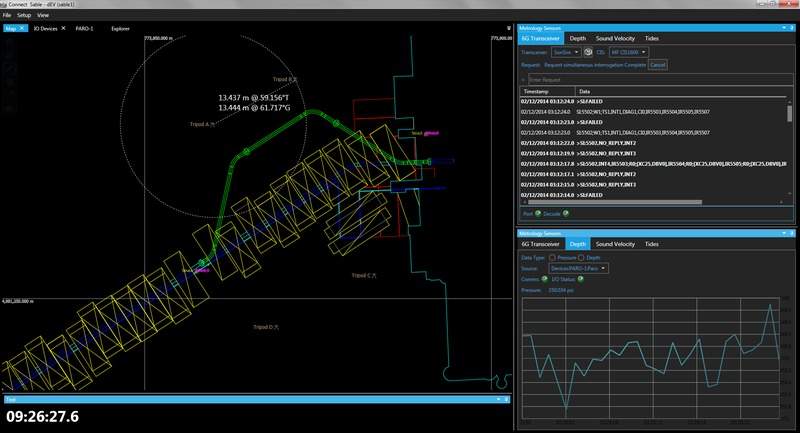
Acoustic metrology calculations software
4D Nav and acoustic instrumentation specialist Sonardyne jointly offer Connect, a complete package that calculates horizontal, vertical and indirect metrologies with direct input from the acoustic transceiver and pressure sensor, as well as import and manual entry capabilities.
A single package offering full project planning, data collection and analysis, long baseline (LBL) network adjustments and reporting in one package, Connect optimizes acoustic metrology operations.
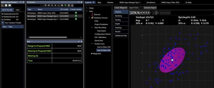
Quality control services
4D Nav’s QCView quality control package analyzes, evaluates and processes survey data in parallel with, but independently of, a survey and positioning contractor to ensure the operation is within the client’s specified tolerances.
It includes the full European Petroleum Survey Group (EPSG) Geodesy of NavView and adds LBL acoustic network calculations, including scale factor application and reduction to the ellipsoid.
4D Nav also provides quality assurance and quality control (QA/QC) services for both field and office-based operations in the drilling, construction, and geophysical industries.
3D modeling services for real-time or simulated exercises
4D Nav offers 3D modeling services in support of its software’s ability to display complex 3D scenes, which typically consist of digital terrain models (DTM), subsea structures, riser lines, flow lines and umbilicals.
Once a scene has been created, it may be used in real-time or in simulations with ships, ROVs and other moving assets.
Engineering analysis services
4D Nav’s professional staff assists with operations by providing analysis services for complex positioning-related problems and data. The company is able to generate detailed pre-analysis error budgets or forensically review a client’s data to remedy difficult data anomalies.
4D Nav understands acoustic, inertial, laser and other measurement systems used for underwater construction, and can reconstruct a survey through careful reprocessing of raw data.
About 4D Nav
An ISO 9001 and Occupational Safety and Health Administration (OSHA) 18001 certified company, 4D Nav was created in 2008 by industry professionals to introduce a new generation of real-time spatial software to the offshore industry.