MetOcean Solutions (MSL) is a science-based consultancy, delivering critical oceanographic and environmental information to support the offshore industry.
From locations near the coast or on the shelf, to remote deep water areas around the world, we provide specialist 24/7 climate forecast, hindcasting services and customised solutions for all stages of an offshore development project.
Working closely with our clients and direct communications with project teams, we design and develop reliable marine and meteorological monitoring tools, vital to help users make informed decisions.
Our solutions include site-specific marine weather forecasts, metocean reports, high-resolution hindcast data, virtual and real time oil spill trajectory modelling.
MetOcean’s high-quality forecast data and consultancy services increase operational safety and efficiency. This translates to minimised downtime, improved production, reduction of fuel and carbon emissions.
Marine weather forecast
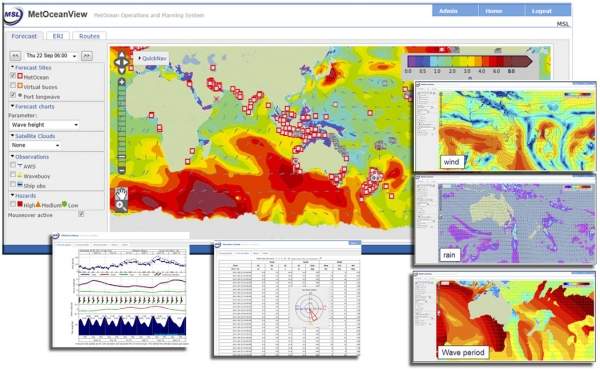
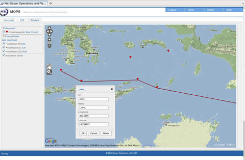
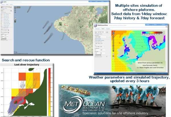
MetOcean’s quality forecast is modelled in house and presented through MetOceanView (MOV), a comprehensive web-based delivery platform. MOV works on a global scale, as well in a high-resolution local scale, allowing customised prediction of ocean conditions.
We run a sophisticated modelling architecture in-house, resolving global scale dynamics at 100km resolution down to the harbour scale at 25m resolution.
Forecast data is produced at hourly intervals, up to seven days ahead, with four cycle updates a day. Data is available as graphs, maps or text via web login 24/7 or auto email reports direct to your distribution list up to four times a day.
MetOceanView data are vital for:
- Vessel motion and kinematics forecasting
- Ship routing and voyage optimisation for heavy lifts vessels, dry and wet tows
- Scheduling heavy lifts crane operations, helicopter and crew vessel transit
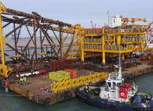
- Planning of seismic survey, ROV and general marine operations
- Pipelay and other offshore construction activities
- Oil spill trajectory forecasting
- Risk assessments, health and safety briefings
The main data products are:
- Wave height, period and direction for sea and swell
- Wind speed and direction, plus atmospherics
- Tidal and wind-driven currents, including water elevations
- Harbour long wave surge
- Derived products, such as wave kinematics and vessel motion
We can also provide directional spectra, spectral widths, shape parameters and modal estimates, and wind at various elevations.
Site-specific metocean reports
MSL’s site-specific offshore climate data is designed to support geophysical survey, exploration and construction operations, for any location worldwide.
From a database of hindcast and remotely-sensed weather conditions, the following analyses are included in our standard site report:
- Monthly and annual wave height statistics
- Monthly and annual wave height exceedence tables
- Operational downtime estimates based on wave height persistence exceedence and non-exceedence (monthly or seasonal)
- Return period wave height extrema (seasonal or annual)
- Joint probability distributions of wave height, wave period, and wave direction
- Monthly and annual wind speed statistics and joint probability of wind speed and wind direction seasonal characterisations
- Tidal range and parameters (elevation and currents)
- Total current statistics and joint probability of speed and direction
- Colinearity and coincidence of environmental forces
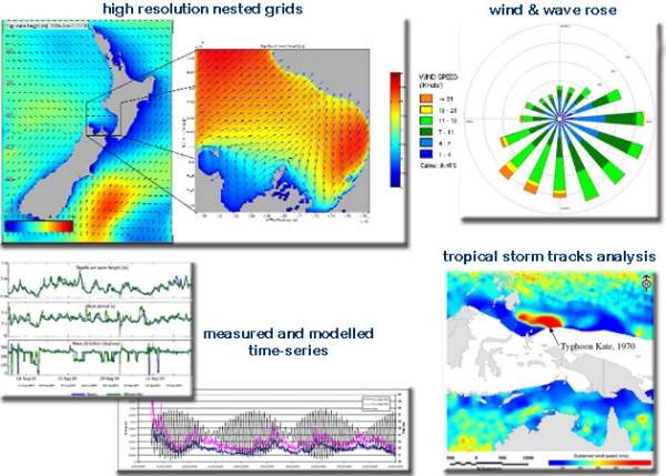
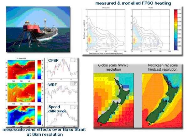
Hindcast data and measurements
MSL’s hindcast system provides key inputs with historical oceanographic conditions for effective management of present and future marine structures.
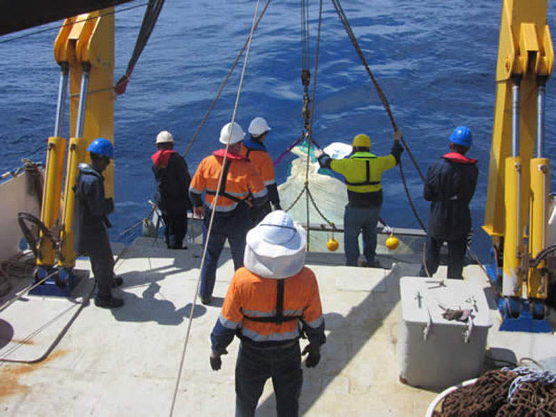
We offer a rapidly deployed, powerful tool for providing information on wind, wave and currents for up to a 31-year period. Our hindcast data is a vital input to define and specify the safety, design and durability of marine structures such as:
- Subsea cables and pipelines
- Riser systems and moorings
- Production and exploration platforms
The hindcastdata is provided as a time-series of wave, wind and current conditions, including:
- Significant wave heights plus sea and swell
- Wave directions of sea and swell
- Peak (dominant) period of the waves
- Wind speeds and directions
- Tidal elevations
- 2D currents driven by tides and wind
Customised data products and analysis is also available. When required we can generate and store the metocean hindcast information in a 4D model archive, from which a range of combined spatial and time-series analysis can be undertaken. All relevant parameters are archived (i.e. winds, waves and currents) in one file for all time-steps (i.e. up to 31 years of data at hourly time steps) for the full spatial domain.
Oil spill trajectory forecasts
MSL’s Emergency Response interface (ERI) provides a real-time oil spill trajectory forecasts for emergency spills. An online pre-emptive tool, it helps response teams to act immediate with the knowledge of weather and simulated spill trajectory.
The computer generated visual representation of an oil spill is specifically designed to give responders an instant ‘heads up’ on the likely plume trajectory in the event of an incident, responders can immediately see how the spill likely to behave over the next seven days and have instant prediction of beaching locations to plan and deploy emergency response operations.
Minimising the impact of pollution
Operators can target resource deployment to minimise the impact of pollution. ERI works on a global scale and is often provided together with our MetOceanView high resolution forecast.
Our services include:
- An emergency response system which uses our specialised marine forecast data integrated with trajectory models
- Automated oil spill maps – producing a spill trajectory every forecast cycle
- Oil spill impact modelling – oil spill impact reports based on hindcast weather
- Trajectory modelling – used in numerous scenarios involving oil spill, search and rescue, pollutant, drill cutting discharges, larval and microbial dispersion
- Discharge plumes – modelling of the plume dynamics for a variety of discharges including produced water, cold water, sewage and suspended sediments
Applications for oil spill forecast include:
- Exploration wells
- Spill response training
- Oil spill response
- Search and rescue