
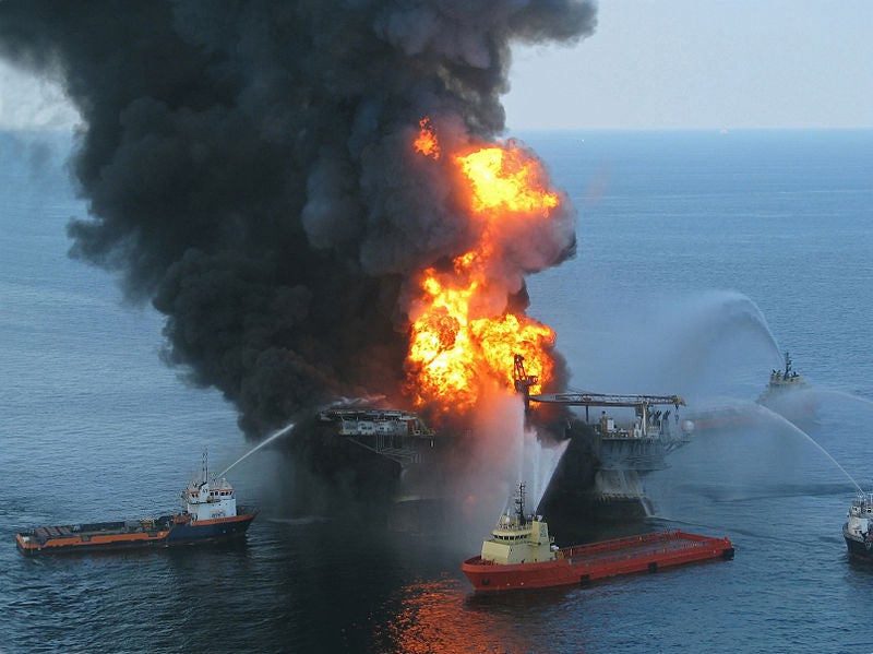
Marine scientists have concluded oil from the Deepwater Horizon oil spill covered a larger area than anyone could see.
Go deeper with GlobalData

Discover B2B Marketing That Performs
Combine business intelligence and editorial excellence to reach engaged professionals across 36 leading media platforms.
Their paper, Invisible oil beyond the Deepwater Horizon satellite footprint, was published in the Science Advances journal on Wednesday. It looked at the possible reach of the oil spill caused by the 2010 Deepwater Horizon disaster in the Gulf of Mexico.
The paper cites observations that lower concentrations of oil spread further than could be seen in satellite imagery. However, these concentrations would still be toxic to wildlife.
One cited experiment showed high oil concentrations in water east of Pensacola, Florida, 11 days after it was last visible by satellite. The measured concentration was around 150 parts per billion, much greater than the roughly 1.8 parts per billion found to be toxic.
The paper used satellite imagery, tests on water and sediment, and mathematical models of how oil spreads to make an experimental model for the reaches of the toxic area.
It begins: “It is important to state that satellite detection is the immediate, primary, and most reliable source of information regarding the presence of high oil concentrations at the surface, particularly for purposes of oil spill response and clean up.”
However, the authors used computer modelling to determine: “[…] toxic and invisible oil extend beyond the satellite footprint at concentrations that present potentially lethal and sub-lethal hazards to a wide range of [organisms] under a range of circumstances found in the Gulf of Mexico”.
It says: “In future oil spills, toxic and invisible portions could be computed on the basis of the quantitative framework presented here.”
Unknown effects on human health
It also suggests some oil molecules could have formed carcinogenic chemicals by interacting with ultra-violet light. These interactions and how long the chemicals stay in the food chain are “not well studied”, and “could have implications for human health”.
Other studies the paper references said oil may have impacted areas from Texas coastlines to the southern tip of Florida.
Another paper concludes oil may have spread further underwater than on the surface, as this would be “both plausible and consistent” with damage to fish on the West Florida Shelf.
The Invisible Oil… study also cites European Space Agency data showing concentrations of oil in the Loop Current, a part of the Gulf Stream which moves water around the Gulf of Mexico.
This would be well beyond the southern reaches of the largest fishery closure at the time. As such, it says the closure of fisheries “failed to capture” the oil spill off the coast of Texas, West Florida, and in the Loop Current.
