
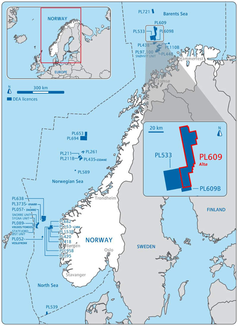

Alta oil and gas field is located in the production license PL609 of the Barents Sea, approximately 160km off the Norwegian coast.
Recommended White Papers
Recommended Buyers Guides
The field is located 20km away from the Gohta discovery in water depths of 388m.
Lundin Norway is the operator of the field and holds 40% interest in the asset, while the remaining is owned by DEA Norge (30%) and Idemitsu Petroleum Norge (30%).
Alta oil and gas field discovery
Alta was discovered during the 7220 / 11-1 exploration project in October 2014.
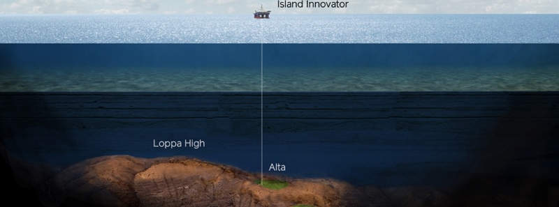
The well was drilled to a depth of 2,221m by the Island Innovator drilling rig and encountered a 55m-thick hydrocarbon column in good quality reservoir rocks.
Two drill stem tests (DSTs) were also performed on the well, which flowed at the rate of 518 standard cubic metres of gas a day (Sm³/day) of oil and 48,700Sm³/day of associated gas.
Geology and reserves of Alta field
The Alta discovery is estimated to contain between 125 and 400 million barrels of oil equivalent (MMboe), which is located in the Permo-Carboniferous carbonate reservoir of the Loppa High region of the Barents Sea.
Alta oil and gas field appraisal
Lundin completed the drilling of the 7220 / 11-2 delineation well and the 7220 / 11-2 A side track in June 2015.
The wells were drilled to depths of 2,020m and 2,041m respectively by the Island Innovator drilling rig. The well was drilled in order to confirm the reservoir structure of the discovery and also the presence of hydrocarbon columns.
The delineation well struck a 50m-thick gas column in reservoirs of varying quality. It also encountered an oil zone but without any reservoir qualities.
This meant that a side track well was drilled approximately 300m west of the delineation well, which encountered oil in reservoir rocks of moderate quality.
Extensive data was acquired from both wells, revealing communication between the delineation, side track and discovery well. Both the wells have now been permanently plugged and abandoned.
Another appraisal well, 7220 / 11-3, and side track, 7220 / 11-3 A, were drilled to depth of 1,925m and 1,962m respectively in September 2015. These were drilled on the eastern part of the discovery, roughly 4km from the discovery well and 3km north-east of the earlier appraisal well.
The purpose of drilling the second appraisal well was to further confirm the presence of hydrocarbons and oil and gas contact in the discovery well. The 7220 / 11-3 appraisal well struck a 120m-thick hydrocarbon column in good quality reservoir rocks, while the side track encountered a 74m-thick hydrocarbon column in reservoir rocks of different qualities.
The well was plugged and abandoned, with measures in place to enable re-entry at a later time.
Successful re-entry of appraisal well 7220 / 11-3 A was achieved in June 2016.
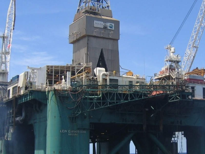
The re-entry was drilled to a depth of 2,575m by the Leiv Eiriksson drilling rig, and was intended to further assess the quality of the reservoir.
A production test was performed in the Lower Triassic reservoir section of the well, which produced at the rate of 595,000Sm³/day.
Alta oil and gas field development
Lundin plans to develop the field along with the nearby Gohta discovery project and feasibility studies are currently being carried out, with additional concept studies planned for later in the year.
Further appraisal of the field is also planned in 2017 in order to fully delineate the Alta structure.